|
|
|
NAVIGATION & GPS
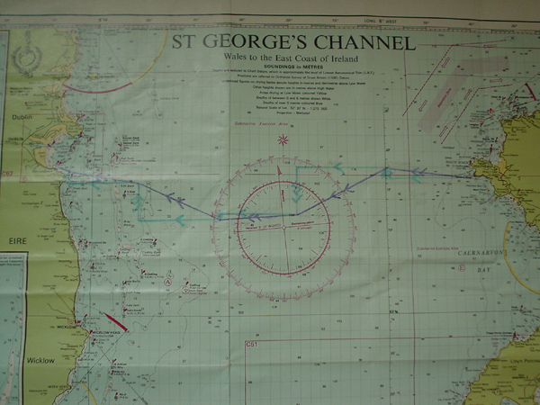
Holyhead to Dun Laoghaire - Pic: Barry Shaw Ideas, suggestions or broken links? Please email me with details. |
| Bing Maps will help you find places. Bouyage - Factsheet from Cailean MacLeod. (.PDF). Sailtrain.co.uk also offers some in-depth and useful material. Charts - Admiralty Hydrographic Office folio of charts for the area from Mull of Kintyre to Ardmurchan Point including Mull, Iona, Tiree, Coll, Jura, Islay and right up Loch Linnhe to Fort William - £37.50. They have a similar folio for other areas, including the Clyde. They also offer an Electronic Chart Plotter on CD at £49.95 - (prices as at Jan 2006). Marine Chart Services sell used and "cancelled" charts at very reasonable prices, as well as new ones. Maptech-Marine "digitally reproduce charts from reputable world institutions including the British Admiralty with all the colour and detail found on the paper original". Memory Map offer a full set of charts for UK and Ireland for about £40 for the disc. Choosing GPS - discussion ColRegs/ International Regulations for Preventing Collisions at Sea - from Sailtrain. Contour Maps - free vector contour maps, all paid for with US tax dollars! Garmin etrex - USB cables - discussion GPS - discussion GPS - choosing a GPS and using mapping software - discussion here, and a very detailed discussion here with reference to charts and GPS. GPS - Garmin GPSMAP 76csx GPS track data - discussion International Rules for Preventing Collisions at Sea from Sailtrain.co.uk. Useful to know about, not that you should expect shipping to actually apply it to you, even if you are supposed to have priority! This article from Sea Kayaker magazine gives a nice concise summary. Lattitude & Longtitude / OS Grid Refs - Factsheet from Cailean MacLeod. (.PDF) Magnetic deviation / declination - useful website which will tell you the current declination in any given area. Unlike some of the other ones, this site covers "true" and "grid" north. Mapping software for Mac's - discussion. Douglas Wilcox has some mapping software reviews in his blog. Maps - Ordnance Survey Maps from the OS, the National Mapping Office of GB. Maps and tidal data - Ricb250 produced this excellent resource. Maps - Norway - see this discussion for some mapping resources. Maps - how to scan maps in a Uniden Mystic. Matty's Tasmanian Aventures includes a detailed review of the Garmin GPS Map 60CS. Military Exercise Areas - Ministry of Defense contacts for some of the military exercise areas are to be found in this discussion and this one. The SCA has some useful information about military exercise areas in Scotland. See Scottish Naval Exercise Areas Information for information about Naval Activity in Scottish coastal waters. The site is divided into 3 main sections dealing with the QHM Clyde (Gareloch and Loch Long), the Scottish Exercise Areas (SXAs) and activity at the Cape Wrath Firing Range. Moon Phases - useful for trip planning. Navigation - discussions here and here with ideas for technique for long crossings. Discussion here on tools and resources. Navigation Board - superb idea from Julian Patrick for organising charts/maps. Nautical chart symbols etc - useful reference - it seems to cover more or less the content of "Chart 5011", the 80 page "Symbols and abbreviations used on Admiralty Charts". Overlay Maps for GPS - discussion Paddling Speed - Factsheet from Cailean MacLeod. (.PDF). See also this excellent work by Julian Patrick on calculating time, taking tide into account which includes downloads for his "crib sheet" and Anglesey tidal constants. Pilots - Imray pilots (incs Clyde Cruising Club). Admiralty publications. Tidal stream atlases - list of publications. "Reeds PBO Small Craft Almanac" - "contains many unique features for small craft sailors and represents excellent value for money. Meticulously researched, this popular almanac contains a wealth of information presented in an easy to find, quick reference manner. Covers the whole of the UK and Ireland and the west coast of Europe from Denmark all the way to Gibraltar. The contents include: Secondary port differences, over 2500 waypoints, tide tables, tidal streams and tidal gates, radio data, Light recognition, weather information, Principal lights, IALA buoyage, International codes and flags, sun/moon rise and set". In other words, worth having. From Amazon or chandlers. "Sea Kayak Navigation" - an excellent, practical and concise work by Franco Ferrero, published by Pesda Press. Recommended reading. Southampton water - the Ports Authority website would be worth a look if you're planning on going there. The live radar is a nice touch. Understanding charts - UKDivers.net has an excellent article on charts
Some GPS-related Links (from Jim Wallis)... Manufacturers...well, who is really in the handheld outdoor market, Garmin www.garmin.com/ and Magellan www.magellangps.com/en/ are the main ones but Silva www.silva.se/ also have some. Probably the best piece of shareware in the world, but only if you have a Mac! This up to date piece of software magic even works on my ancient powerbook 160 (System 7.5.5) with the addition of some extra libraries from apple. For PC users, their links page is really comprehensive too! www.gpsy.com/ For Palm users try this out: www.gpspilot.com/ I don't currently have any GPS software on my PC because compared to the above everything I tried sucked! There are however loads of utilities for transferring those all important tracks and waypoint files - many of which are listed on the GPSy website above. For equipment these people are pretty cheap www.globalpositioningsystems.co.uk/ ...and for specialised leads if you can't make your own try these guys www.pc-mobile.net/ (actually in Japan I think). GPS Maps There are several sites where you can download maps including microsofts mappoint and our old friend streetmap www.streetmap.co.uk/ Unfortunately you'll have to do some calibrating yourself to make any use of them. The GPSpilot software actually gets into mappoint (actually vicinity which is now part of mappoint) and gets pre-calibrated maps that work straight away - I haven't worked out how to do this without GPSpilot though. If you want to buy maps on CD try DeLorme www.delorme.com who have a bias towards the US as do National Geographic maps.nationalgeographic.com/topo/ Garmin also have a range of map CDs covering the whole world, and also a range of charts www.garmin.com/ Many outdoor shops are stocking anquet's maps on CD anquet.co.uk/ but they seem hideously expensive compared to the American brands :-( Compare an entire state for $99 with the english lakes for around £100! Overlay Maps for GPS - discussion
|
(Updated 06-May-2015 )
|
|