|
|
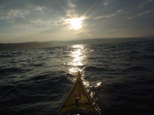
After 5 hours of driving through the night I finally arrived at Stranraer just before 3am looking for somewhere to park the car and have a sleep before setting off to paddle over to Larne in N.Ireland. I managed to find a small car park at the foot of Killantringan lighthouse on Black Head a couple of miles north of Portpatrick. I managed to get about 3 hours sleep in the back of my car until 6am when I went in search of somewhere to launch. Portpatrick harbour was ideal with somewhere to leave the car and the water was only a few metres from the slipway. The forecast was SE 3-4 and 5 in the north channel which seemed pretty good to me. The tide had been ebbing for about the past hour so I expected to drift NW for a few hours then around slack water I planned to alter my course so that I wouldn't have to ferry glide for the last hour or so. I was hoping to spend the night on Islandmagee so it was a large target I was aiming for. At 7.45am I paddled out of Portpatrick harbour with the sun shining down on the sea and I had a really good feeling about the day. Over to my right I could see Killantringan lighthouse which marked Black Head where I had just spent the night, whilst a pair of gannets circled a couple of hundred metres ahead of me.
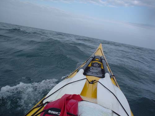
Leaving Portpatrick Once I was about a mile out the wind became a little stronger and I seemed to be drifting north with the tide fairly quickly. Quite soon I was paddling with an increasing quartering sea and the further I went the more the waves helped me speed along. After only an hour all sight of land behind me disappeared.The sea was just perfect and the boat seemed to be flying along. Every few minutes a row of waves would come rolling along to give me another push forward,it was fantastic fun and I still had another few hours of this to go.
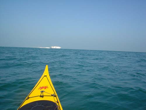
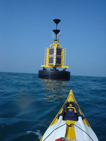
The wind became stronger in the channel. After around 2 hours I felt that I was being pushed further north than I wanted to be but the temptation to keep playing on the waves was too much and I decided to carry on as I was and just head south when I reached the other side, after all I wasn’t due to be picked up from Larne till the following day so I was in no rush. About 4 hours into my trip it became obvious that I was a few miles NE of Larne as I could see the ferries heading into the port. I could see 2 cardinal markers ahead of me which marked Hunter Rock and from there I paddled to a small headland just before the entrance to Larne harbour.
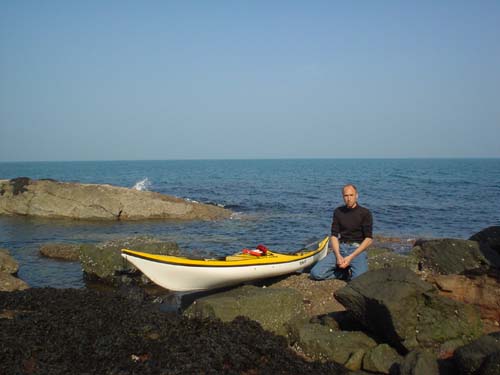
5 hours 40 mins after leaving Portpatrick I pulled my kayak up onto the rocks to go and find somewhere to pitch my tent for the night. I soon realized that I was going to have to wait until evening time to put it up as the flat piece of grass I’d chosen was right next to the 17th green on the local golf course.
The landing point. That night I learned that charts can be useful off the water as well when at 1am I was woken by the loudest fog horn imaginable which came from a building I was camped next to, clearly marked on the chart was HORN (1)30S. This continued right through until 5am by which time I’d had enough and was already up and packing. As soon as I was packed I headed across to the harbour where I loaded my kayak onto a trolley and wheeled it to Larne ferry terminal where I managed to have a couple of hours sleep in the car park before meeting up with Carol who was giving me a lift back to Portpatrick in Scotland. Barry Shaw - 2005 Barry likes the Irish Sea - see also his trip report on the crossing from Holyhead to Dun Laoghaire
|