|
|
Walking all the day, near tall towers
The West Coast of Ireland. The Atlantic Seaboard. For me this has always conjured up images of wilderness, of beautiful, committing, wild seas, of remote islands and peninsulas, of music and craic. Oh, and Guinness. It’s very easy as a visitor to Ireland to see the place as it’s depicted in picture postcard images everywhere: preserved for posterity and still living in the 1930’s. However we found very much the opposite: this is a country which is booming, and its traditions are living and breathing. Gaelic is a spoken language, there is music in almost every pub for locals as well as tourists, and new piers are being built on the islands to bring the ever increasing numbers of visitors in the summer months. Six of us boarded the ferry at Holyhead at 2.30am, with 2 cars and six boats. We are all regulars of North West Sea Kayakers, but had never done a trip together as a ‘team’ before, and we were a pretty disparate group, with as one paddler put it, ‘many hidden talents’! First stop, the kiddies play area- soft mattresses and things you can use as pillows for some much needed sleep. Shame about the kiddies that insist on playing right through the night! Somehow, we all managed to sleep, and were woken by the tannoy at 6am, telling us we’d arrived in Dublin. Sleepily we stumbled back to the cars and off the ferry, and after getting lost and finally negotiating the road works around Dublin Port, we were on the N4 and heading West. After the obligatory ‘Full Irish’ breakfast at a truck stop with just about all the other ferry passengers, we wound our way towards Galway. I was in the back and desperately wanted to sleep, but surrounded by dry bags and paddling gear I was far too excited. I was also mildly concerned that the wind was getting up, and forecast to continue that way. On the ferry we had decided that Clifden would be our starting point. We separated - one car opting for the direct route, and our car heading round the coast road via Roundstone, billed in the guidebooks as ‘the most idyllic hamlet in Connemara’. I had a particular interest, as my second greatest passion (after paddling!) is folk music. I wanted to visit Malachy Kearns music shop - located in a monastery, and makers of beautiful goatskin Bodhrans and other traditional instruments. Whilst in Roundstone, though, we also sampled the most wonderful fresh Seafood Chowder I’ve ever tasted. And it seemed as though all the cafes and pubs sold it. Leaving Roundstone, we drove the coast road, watching the landscape become rockier and more barren by the minute. Houses built of stone collected from the land around them appeared to grow out of the ground. No wonder the area is known for its solid dry stone walls: if you want to cultivate the land, all those rocks have to go somewhere. Finally we could see the sea - without the Atlantic swell that I’d expected, but the wind was trying very hard to rectify that. Just the beginnings of the surf the area is famous for was visible on the pristine, empty white sandy beaches.
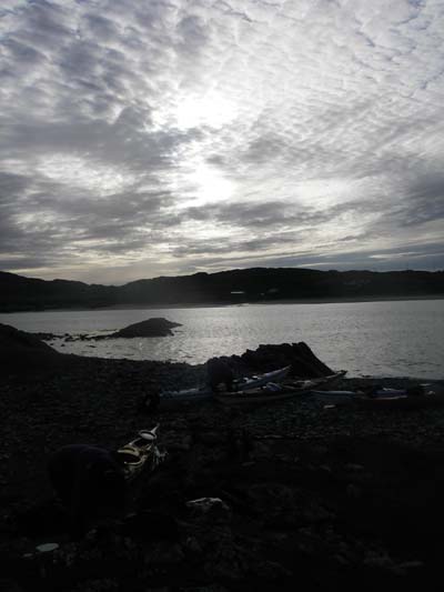
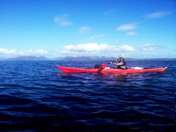
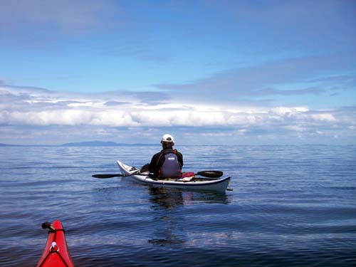
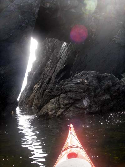
Once tents were up at the campsite in Clifden (yes there is one - just ask!) and dinner had been eaten despite the midges, we ventured into the ‘town’. There we experienced the legendary Irish sales pitch: ‘If there are fish out there, this is guaranteed to catch you one’! We found our first ‘proper’ Irish pub of the trip: Mannion’s. Outside plaques proclaimed it ‘Pub of the Year’ and ‘Music Pub of the Year 2004’, and they weren’t kidding. Despite protests of tiredness, and one or two having to give in & go to bed, some of us enjoyed the music, craic & Guinness until the wee small hours in what turned out to be a pub full of seriously friendly locals. Next morning boats were packed in midge-free sunshine at the slipway, and we all eventually emerged from under the piles of gear that somehow fit into far too little space on the first day of a trip. The water and land felt very Scottish when we set out - the kind of paddling I’m most familiar with - and never failed to remind me of Scotland as the trip progressed. As we came to Turbot Island, or Tairbeart, we began to see signs of the culture unique to the West of Ireland. Along with its neighbour Inishturk, this island was once inhabited. When Tim Robinson wrote about it in his book ‘Connemara’, just one family remained. The people made their living from the sea, using Curraghs for fishing: small open boats, barely bigger than Canadian Canoes, and rowed by two men. Nowadays they’ve given up rowing, and the curraghs buzz around with outboard motors on the stern. We passed a Galway Hooker, the other traditional craft of the area. After lunch in the sunshine on the beautiful white sandy beach at Aughrus Point, we struck out for Inishbofin, our first offshore island. I paddled a slight distance from the others, enjoying the motion of the open Atlantic and the sea birds wheeling nosily around my boat: black guillemots, oystercatchers, razorbills, shags, terns doing a spot of fishing, and a solitary gannet. All around were islands and stunning coastline; a lifetime of paddling, of nooks & crannies waiting to be explored. We pulled into Bofin Harbour, to the first signs of the booming economy, or possibly EU subsidy…a massive new harbour wall. Then round to Inishlyon. This island was chosen to avoid the midges, but turned out to be a lovely camp spot with a view of the beach opposite on Inishbofin. ‘Oilean’, the Irish kayaking guidebook, mentions a ‘fierce tide race’ at Lyon Head, but we saw nothing of it, with calm seas & sunshine. Day Two was a day of open crossings: First of all, to another Inishturk. The 6 mile crossing took the best part of two hours, and we were rewarded with an extraordinarily friendly welcome. The guys building the new pier, shipped in each week from the mainland, chatted to us awhile. We befriended Delia, a local lady who filled our water carriers and gave us some tips on catching fish in the area. We detoured to Caher Island to investigate the caves on its Western end. Here the power of the Atlantic groundswell was in evidence surging over submerged rocks, despite the calm sea state.
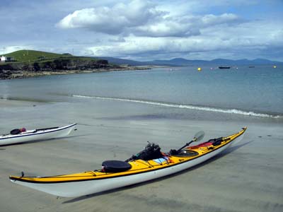
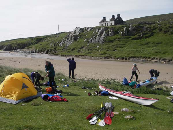
Crossing to Clare Island
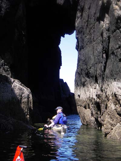
Boats on the beach - Clare Island Crossing to Clare Island, the fishing line was tried for the first time, and eventually, in the shallows just off its shore the sales pitch ‘guarantee’ given to us in Clifden came good: Mackerel! I found a hidden, skinny arch to paddle through, probably only paddleable in absolute calm at that state of the tide, but the rest of the group were far more concerned with catching dinner! The landscape, like most of the area, is covered in Lazybeds, their name belying their method of creation and purpose: sand and seaweed, carried from the shore in baskets by the women to produce fertile ground for growing crops.
Another open crossing brought us to Achill Beag, the little brother of Achill Island, and our timely (as it turned out) bolthole closer to the mainland. Achill Beag is a deserted Island, but still has the remains of a village very much intact. It reminded me very much of Mingulay in the Outer Hebrides, with a similar layout: the village clustered around the sandy beach. These islanders remained far longer than Mingulay’s; the last 38 people leaving in the 1960’s. The island is still grazed, as are most of the Irish offshore islands, and one or two of the houses have been restored as holiday homes.
Achill Beag Force 6 was forecast for the following day, so we decided to have a ‘tea and sticky bun’ lunch stop halfway up Achill Sound…a sort of mini Menai Straits. The tide floods and ebbs from both ends, so you catch the flood tide north, have pasty, cake & tea in the cafe, wait for it to turn and then catch the ebb north again! With the wind funnelling in from the south this was our easiest day yet. Round the top of Achill Island I found some lovely little nooks & crannies for rockhopping, and we picked our campspot at the North end of the Island. I don’t particularly like being stormbound, and this night was no exception. The wind and rain closed in almost as soon as we landed, and we retreated into our separate tents for the night. I decided to brave the rain for a brief walk and discovered a very surreal sight: a Black Taxi Cab parked in the middle of the sand dunes! Motivation was lacking somewhat next morning, when we woke to pounding rain and wind. The early morning forecast wasn’t even audible due to the volume of rain on flysheet! All plans were revised when we finally emerged, and we decided to retrace our paddle strokes to Achill Beag (via the sticky bun cafe!) to try to paddle into Westport & the Clew Bay islands the next day. The weather brightened as the day went on, and the 5-knot tide race at Bull’s Mouth (with a Southerly Force 5-6 wind-over-tide to kick it up a bit!) served to provide a bit of entertainment along the way, near the fantastically named Inishbiggle. Having dripped all over the floor in the cafe again, we fought the wind back down Achill Sound. However, almost as soon as dinner was over on our second night on Achill Beag the rain arrived with a vengeance. Next morning the little stream was a peaty torrent, and we’d had enough. We bolted to Achill Bridge in stairrods rain, and the two drivers jumped in a taxi bound for the cars in Clifden. We found rooms in the hotel at Achill Bridge, a meal and hot showers, with a view to heading for Westport and a day paddle for our last day. At the sailing club slipway in Westport we met another group of kayakers - strangely enough from the same area of the UK as most of us. They had much the same story, and were also planning a day paddle in the shelter of the Clew Bay islands. We fought into the wind towards the lighthouse, and through a sound or two into the extraordinary maze of sunken drumlins that guard the entrance to Westport Bay…some of which are inhabited. I was amazed at the greenness & fertility of the ground - so different to the Connemara coastline. Navigation amongst the islands was a test of all our skills, but just added an extra dimension to a fascinating & lovely day. Westport provided a campsite with showers (luxury!!), and a short walk into town found us in a pub with live music, which could only be considered ‘traditional’ if you believe ‘The Commitments’. We drank and danced the night away and celebrated the end of a fantastic trip to the sound of an Irish woman singing classic Blues, Soul & Jazz. We boarded the ferry to Holyhead the next evening. Passing the lighthouse while the sun set over Dublin, a gull hovered behind the boat. I reflected on a week with a little of everything: good company, great paddling. Beautiful and varied landscapes where the hands of man and nature are visible in harmony with one another. In my mind I replayed snapshots of deserted islands, and islands with thriving, open, friendly communities; of music, craic, and the surging, powerful Atlantic, and most of all, I looked forward to the next time… Zoe Newsam. Thanks to Andy Biggs for planning the trip & navigating, and managing to keep such a rabble together for a whole week, and to Helen Marsden for chatting up the Irish Coastguard every day. Paddlers were: Andy Biggs, Stephanie Connor, Helen Marsden, Jim Morgan, Glen Parry, Zoe Newsam. Resources: |
||||||