Stacks of Rockhopping
Paddles Touring Guide - Holy Island, Anglesey
|
By Zoe Newsam - 2005 |
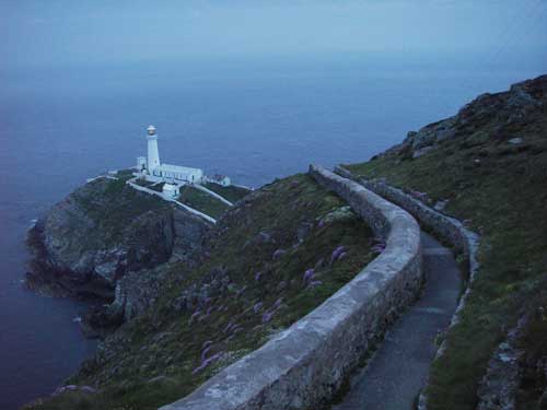
South Stack Lighthouse
|
At the northwest tip of Wales sits an island thought by
many to rival almost any sea paddling destination in the World: Anglesey.
On the west side of Anglesey is Holy Island, the jewel in Anglesey’s
paddling crown. Sea kayakers are drawn to Islands for reasons many and
varied. This one offers variety in the extreme, from the ‘Inland
Sea’ and sheltered flat water, to the playwave at Stanley Embankment;
and from unrivalled rockhopping near Rhoscolyn to the awesome tide races
of ‘The Stacks’. There is something for everyone here. Home
to Nigel Dennis Kayaks; UK Sea Kayaking (until recently ‘Anglesey
Sea and Surf Centre’); the Anglesey Sea Kayak Symposium (originally
known as ‘The Nordkapp Meet’); and more recent additions
in the form of Rockpool Kayaks and Rock and Sea, this area has produced
some of British Sea Kayaking’s brightest stars. They’ve
all cut their teeth in the Tide Races and Overfalls around Holy Island.
If you can paddle comfortably in these waters, then you can almost certainly
hold your own anywhere in the world.
One of the challenges and pleasures of planning a trip in this area
is working out and understanding the strong and complex tidal streams
that surround the island. These are best explained in the Imray Pilot,
‘Cruising Anglesey and Adjoining Waters’, which is an excellent
introduction to the area with really detailed tidal stream diagrams.
Both of the trips described involve tidal sections; if you are in any
doubt about the effects of these, seek experienced guidance first.
Paddler-friendly camping can be found at The Centre (Formerly Anglesey
Sea & Surf Centre - basic but convenient), or the Valley of the
Rocks, both near Porth Dafarch, or Outdoor Alternative, Rhoscolyn. The
Paddler’s Return bar at The Centre, is of interest as the walls
display several decades of British Sea Kayaking history - in the form
of boats and paddles used in expeditions round Britain and Cape Horn,
from Britain to Turkey, and photographs, newspaper cuttings and memorabilia.
Of course being an island, it is possible to paddle all the way around
Holy Island, and there are a multitude of combinations that can be dreamt
up. The two below are my favourites.
Treaddur Bay to Four Mile Bridge
This trip can also be started from Rhoscolyn Bay (marked ‘Borthwen’
on OS maps) to make a slightly shorter day. On a sunny summer weekend
the beach at Treaddur Bay can get very crowded - park in the car park
to the north of the beach. Once you’ve escaped the ever-present
swimmers, divers and tourists, leave the sandy beach for the rocky coastline
en-route to Rhoscolyn Bay. This is studded with little shingle bays,
and with caves, arches and gaps to explore. Because of the large tidal
range here, the coastline changes dramatically during the tidal cycle,
and an arch that was paddled through on the outward journey can be dry
several metres above the water line on the return trip! Look out for
the White Arch as you near Rhoscolyn Head - the name somewhat gives
the game away.
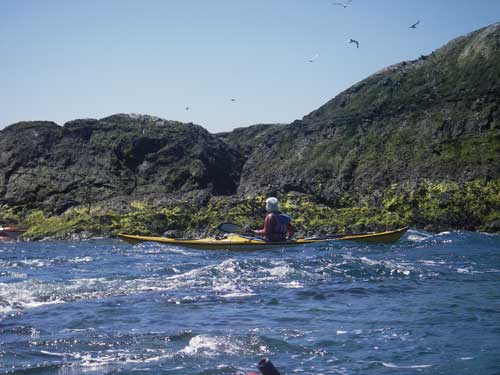
Nearing Rhoscolyn Head, the combination of rocks below the surface and
significant tidal flow can make for an interesting and sometimes lumpy
passage. A short distance offshore, Rhoscolyn Beacon has its own mini
tide race which can prove an entertaining playground with rockhopping
to hand. Keep an eye out for the very friendly seals that inhabit the
various channels and inlets that become exposed at different stages
of the tide.
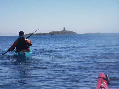
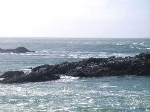
Rhoscolyn Beacon
Penny at Rhoscolyn Beacon
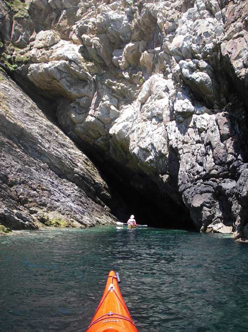
Rhoscolyn Cave
Back inshore at Rhoscolyn Bay there are two beaches: the first shingle,
and the second sandy, with an old lifeboat station at the entrance.
This is a lovely sheltered beach (with car park and toilets) and makes
a great lunch stop, or start/ finish point.
Heading south from the shelter of the beach, the rockhopping is second
to none; take time to explore the inlets and channels. Eventually, the
whirr of helicopter rotors heralds the Valley RAF base ahead. In the
right conditions the little sand bar here in Silver Bay can produce
some beautiful surf. The final section of this trip winds north up the
Cymran Strait, which is where you discover whether your tidal planning
was accurate! Even by sea kayak, it is only really possible to navigate
this passage around 1-2 hours either side of High Water, so make sure
you work this out carefully! If you’re right, you should have
a leisurely end to a gorgeous trip, floating with the tide along the
winding Straits to Four Mile Bridge.
‘The Stacks’: Porth Dafarch to North Stack and
return
If you are an experienced Sea Kayaker you will doubtless have heard
of the Stacks: North Stack, South Stack, Penrhyn Mawr. Names that trip
off the tongue like honey. Be in no doubt, however: this is a classic
but very challenging trip, and involves negotiating some of the fastest
tidal streams in the British Isles. It also passes some astonishingly
beautiful and rugged coastline with very few landing places, and is
continually changing with wind and tide.
While the tide is flooding, launch at Porth Dafarch’s sandy beach.
Parking is free, there are toilets, and in the summer, a tea van! Tourists
abound, and if you’ve picked a Spring Tides weekend with good
weather then you may have to fight for parking space, or arrive early.
Depending on your intentions, either allow time for playing at Penrhyn
Mawr on the flood while the race is still running, or time the first
part of this trip close to slack water at Penrhyn Mawr to avoid the
roughest water. However, the second option makes life interesting in
itself; it will involve eddy hopping around the headland against potentially
quite strong flows. On the flood it is usually possible to sneak through
the ‘Chicken Shoot’, a flatter passage of water close inshore,
but there is no escaping the requirement for knowledge and experience
of tides and moving water, particularly on a flooding tide against a
wind or swell from the north.
Penrhyn Mawr
As you round the first small headland, a gap appears between the shore
and an offlying rock. Be careful here - there are almost always anglers
lying in wait! If the tide is still flooding there will be flow through
this gap, and then the first view of Penrhyn Mawr opens up ahead. Decision
time…
At Porth Ruffydd on the right before you reach the race itself, it is
possible (and recommended, for a great view!) to land on the shingle
beach, walk up the steps at the back of the little bay and follow the
path around the cliff top. This brings you to the headland above the
race for an inspection, if necessary, and is also a great spot for a
few photos! Once playtime is over or you have been bounced through the
smaller inner sections of the race, you now have a choice: The main
tidal flow heads slightly out to sea and can be ‘caught’
around to South Stack if it is still flooding, or you can choose to
stick to slacker water close inshore. On the flood there is a back eddy
in Abraham’s Bosom, the bay to the North of Penrhyn Mawr, which
can be quite powerful in places; however there is also some wonderful
rockhopping to be had. South of South Stack are some extraordinary bits
of geology - rocks folded and tilted, squashed and bent like a deformed
swiss roll.
Beneath the lovely, imposing lighthouse at South Stack, another choice:
inside or outside? When the tide is flowing here the passage under the
bridge runs like a small river and can provide some measure of entertainment,
not least for the tourists on the bridge! The main flow passes around
the outside of the Stack and forms a large and sometimes intimidating
race which can extend up to 7 miles offshore in rough conditions. According
to the Imray Pilot ‘the race at South Stack reaches 6 knots and
can, in suitable conditions, create a confused steep sea with 2 metre
breakers in wind strengths of Force 3’. To quote Nigel Dennis,
‘Fun or Fear’! Once past South Stack, stay inshore for yet
more spectacular rockhopping, but beware: if you spot the Fast Ferry
heading in or out of Holyhead Harbour to the North, stay well clear
of any rocks for a few minutes as they produce an amazingly large wash
that could easily cause a dangerous mishap.
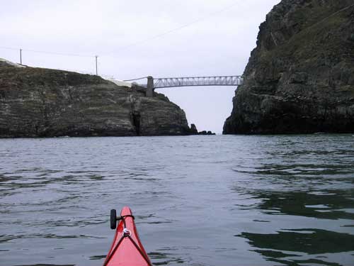
South Stack Bridge
The bay between North and South Stack is Gogarth Bay - sheer cliffs
dropping straight into the sea, where you will often see climbers attempting
spectacularly situated routes. Just before North Stack at the north
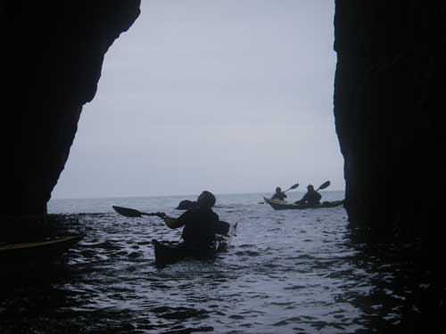
end of the bay, are some beautiful, cathedral-like caves. One has two
entrances and can be paddled right through. Northernmost is Parliament
Cave, a favourite Sea Kayakers’ lunch spot. You’ll doubtless
share it with the two or three seals that inhabit it. Whilst you’re
eating your sandwiches, look above - see if you can spot the climbing
gear dangling from the enormous overhanging roof!
Parliament Cave
Nigel Dennis at North Stack Cave
Around the corner, if the tide is now ebbing (it turns here an hour
before South Stack and Penrhyn Mawr), is North Stack race. This should
be treated with real caution and respect, as it heads straight out of
Liverpool Bay into the Irish Sea - next stop, Dublin. Depending on your
timing of the tides you can either head east towards Holyhead (just
before the breakwater is Soldiers’ Point, an excellent place to
park a second car to finish a one way trip), or turn around and paddle
back to Porth Dafarch, and see a whole different world on the return
journey! There is no real tide race at Penrhyn Mawr on the ebb, just
more classic rockhopping and the odd seal basking in the sunshine.
Additional Resources
"Cruising Anglesey & Adjoining Waters" - Ralph Morris
- Imray
"Snowdonia White Water, Sea and Surf" - Terry Storrey - Cicerone
Ordnance Survey Landranger 114, Anglesey or Multimap.
"This Is The Sea" - Justine Curgenven - www.cackletv.com
- (DVD- for video footage of Penrhyn Mawr)
The Centre, Porth Dafarch - 01407 769351
Outdoor Alternative, Rhoscolyn www.outdooralternative.org
UKSeakayaking / Nigel Dennis Kayaks www.ukseakayaking.com
North West Sea Kayakers www.nwsk.org.uk
Rock and Sea Adventures www.rockandseadventures.co.uk
|